
Gary ZIP Directory Coverage
USPS material associates 46401 through 46409 with Gary postal groupings. Some rows have a named station or neighborhood link; others only have a FAST label grouping, so the table does not invent sharp neighborhood borders. Adjacent 46410 and 46411 belong to the Merrillville postal grouping and appear only to show why a nearby ZIP must not be assumed to be Gary proper.
| ZIP Code | Areas Covered | Post Office | Notes |
|---|---|---|---|
| 46401 | Central or primary Gary grouping | Exact station assignment not located | Postal association, not surveyed city boundary |
| 46402 | Central Gary street-address grouping | Grouped by FAST under Gary 46401 | Verify the exact address |
| 46403 | Miller and Gary lakeshore association | Miller, 518 S. Hancock Street | Station evidence is strong; boundary needs address check |
| 46404 | Gary and Tolleston association | Tolleston, 2407 W. 11th Avenue | FAST groups several west-side ZIP labels here |
| 46405 | Gary postal grouping | Grouped by FAST under Gary 46401 | Exact neighborhood edge not located |
| 46406 | Gary postal grouping | Grouped by FAST under Gary 46404 | Exact city-line edge not located |
| 46407 | Gary and 15th Avenue grouping | 1490 Broadway | Verify street-level match |
| 46408 | Gary postal grouping | Grouped by FAST under Gary 46404 | Exact city-line relationship not located |
| 46409 | Gary postal grouping | Grouped by FAST under Gary 46404 | Exact city-line relationship not located |
| 46410-46411 | Adjacent Merrillville postal area | Grouped under Merrillville 46410 | Comparison only, not verified Gary proper |
The key quirk is structural: FAST groups several delivery labels under central or west Gary labels, while Merrillville begins a distinct adjacent group. These are mail-label relationships, not proof of municipal limits. The Lake County postal boundaries map gives useful context but expressly serves as informational rather than legal or survey evidence.
Verify a Gary ZIP Address
The USPS ZIP Code Lookup has three distinct searches. By Address is the right choice for a specific Gary property. By City and State returns postal codes associated with a place label. Cities by ZIP reverses the question. USPS warns that a ZIP result does not confirm that a person or company is present at the address.
| USPS search | Fields | Best use |
|---|---|---|
| By Address | Company optional; street, city and state required; unit and ZIP optional | Confirm one mailing address and ZIP |
| By City and State | City and state required | List ZIP associations for Gary |
| Cities by ZIP | ZIP required | Check accepted postal city labels |
The screenshot below comes from the official USPS lookup and shows the address-level starting point.
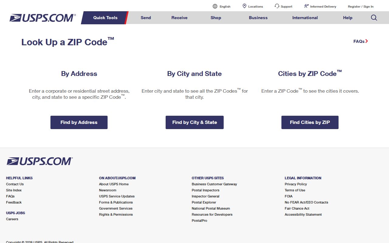
Enter the full street and unit when known. Then compare the returned postal label with Lake County municipality data before drawing a city-limit conclusion.
Gary ZIP Stations as Anchors
Three USPS locations provide useful local anchors. Miller station is at 518 South Hancock Street in 46403. Tolleston station is at 2407 West 11th Avenue in 46404. The 15th Avenue location is at 1490 Broadway in 46407. A station address helps orient the postal geography, but it does not define the outer boundary of that ZIP.
The official USPS location page for Gary shows the kind of station detail used here.
Review the Gary post office details before planning an in-person postal visit.
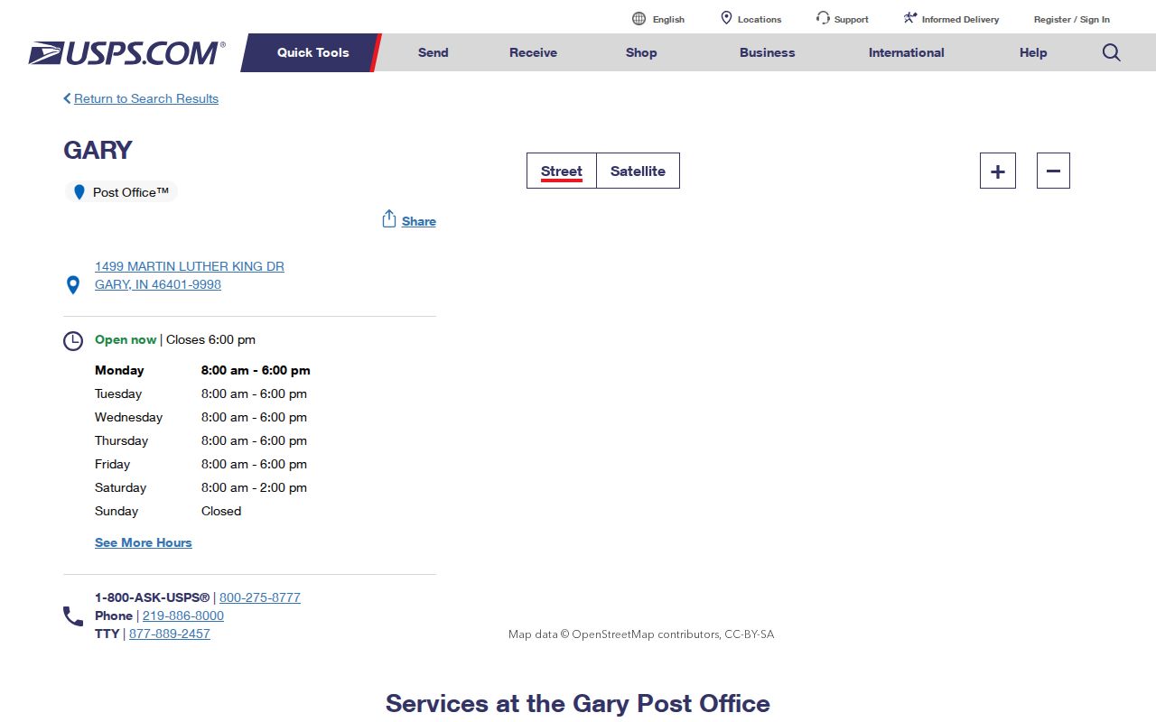
Use the live USPS location record for current service and hours. The station name is a geographic cue, not a resident list.
Find Gary Residents by ZIP
Lake County GIS is the strongest official ZIP-wide parcel route because its parcel data exposes location ZIP and mailing ZIP fields. The assessor search accepts owner, address, or property number, but no ZIP control was observed. Indiana Voters searches by a person's first name, last name, date of birth, and county, not ZIP. MyCase filters by court, case category, status, and dates rather than postal area.
- Validate the complete address with USPS. Record the ZIP and accepted postal city label.
- Query the Lake County GIS parcel layer by its location ZIP field. Compare situs address, municipality, township, parcel ID, and legal description.
- Open the assessor detail by address or parcel number. Treat the owner and mailing address as property facts, not a household list.
- Use a name-based official source only after the ZIP has narrowed the geography. Retain the source URL and date checked.
A ZIP-wide export can contain many parcels and mailing addresses outside the location ZIP. Keep LoczipCode and mailzipCode separate. Once one street is identified, the Gary directory by street carries the work down to address and parcel level.
Gary ZIP Search Channels
Each public tool answers a different ZIP question. The asymmetry matters: GIS supports ZIP queries, but the assessor and voter tools do not offer a broad ZIP filter in the inspected forms. A recorder ZIP field could not be verified because the search route redirected to an account login.
| Official source | ZIP input observed? | Useful returned geography |
|---|---|---|
| USPS lookup | Yes, optional by address or required for Cities by ZIP | Postal ZIP and accepted city label |
| Lake County GIS parcel data | Yes, LoczipCode and mailzipCode | Municipality, township, situs, mail address and parcel |
| Lake County assessor | No ZIP field observed | Owner, address, parcel, legal description and district |
| Indiana Voters | No, county is required | Individual match and polling context |
| Indiana MyCase | No | Court, case type, status and filing date |
Save the parcel ID before moving between GIS and assessor records. It is more stable than a postal label and helps prevent a Gary mailing address from being confused with a parcel outside the incorporated city.
Gary ZIP Labels Are Not Borders
USPS FAST material inspected for an August 1, 2025 effective date groups 46401 through 46403, 46405, and 46407 under a central Gary label. It groups 46404, 46406, 46408, and 46409 under a west-side Gary label. Nearby 46410 and 46411 are grouped under Merrillville. This is a mailing-label system, not a city boundary map.
The official USPS FAST label list supports that comparison.
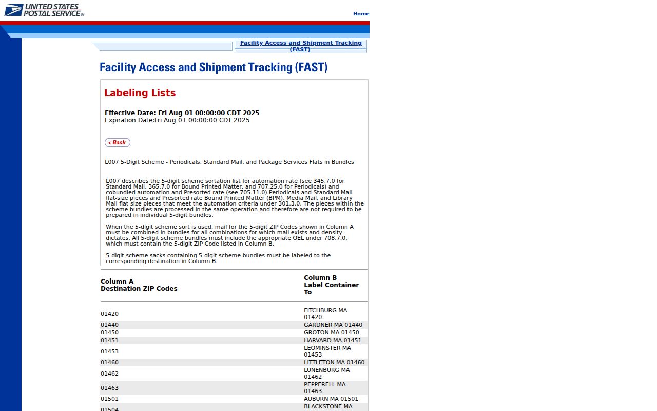
The separate Gary and Merrillville groupings are a useful caution, but only an address-level USPS result and local GIS can settle a specific location.
Bridge Old Gary ZIP Addresses
Historical Gary addresses may need more than a modern ZIP code directory. The municipal code describes Broadway as a primary reference and uses a number-west-street or avenue form west of Broadway. No verified citywide renumbering table was found, so an old number should be paired with a map year, subdivision, lot, block, Sanborn sheet, legal description, and present parcel ID.
Useful sources include the 1911 and 1912 northern Lake County maps, a 1915 city-engineer map, Gary and Miller Sanborn editions, and city directory street sections. Modern Lake County GIS closes the loop. For a disputed or new address, contact Gary planning or zoning and county GIS rather than asking a postal tool to decide legal address authority.
Gary Zoning resources provide the city land-use side of that inquiry.
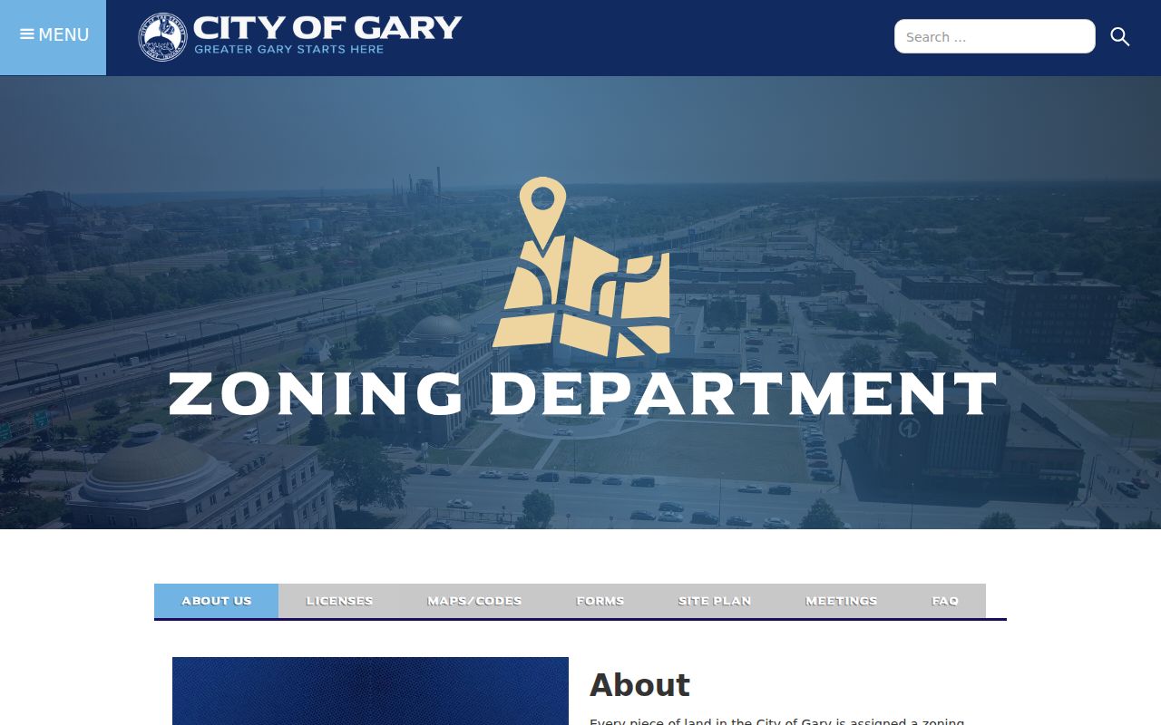
Zoning and parcel records explain municipal context; USPS still controls the delivery-oriented ZIP answer.
Separate Gary ZIP Districts
A postal code should not stand in for a precinct or taxing district. Lake County publishes individual precinct maps for Gary's six precinct groups, and those lines can change. The assessor uses district choices such as Gary Corp/Calumet and Gary School. GIS adds municipality and township fields. Each system was drawn for its own public task, so overlapping lines are normal.
For civic research, identify the record's controlling geography first. Election questions go to the Lake County precinct maps and Election Board. Parcel tax questions use the assessor's district field. Land-use questions use Gary zoning and municipality data. Mail questions return to USPS. A ZIP-wide result can help sort records, but it cannot establish a precinct assignment, school boundary, tax rate, or incorporated-city status.
Note: Lake County marks its precinct maps as current snapshots because election boundaries may change over time.
Gary ZIPs Versus City Limits
A Gary postal label can cover a broad delivery area, while an incorporated municipality field answers a different question. ZIP also differs from precinct, tax district, school district, township, and sanitary district. Lake County assessor district choices distinguish Gary Corp/Calumet, Gary School, and other county districts; GIS exposes municipality and township; election officials publish precinct maps. None can substitute for the others.
One parcel can also have a Gary situs address and a mailing address elsewhere. That is not an error. It may reflect where the owner receives tax mail. Always compare situs city, mailing city, location ZIP, mailing ZIP, municipality, and parcel ID before calling a result a Gary resident match.
- ZIP and ZIP+4
- A five-digit delivery area versus its added four digits for a smaller delivery segment.
- PO-box ZIP
- A code used for post-office boxes rather than ordinary street delivery.
- Unique ZIP
- A ZIP assigned to one high-volume organization or institution.
- Carrier route
- A postal delivery sequence within a ZIP, not a municipal or parcel boundary.
Boundary check. Use USPS for delivery, Lake County GIS for municipality and township, and the assessor for parcel and taxing facts.