
Walk a Gary Street by Address
A sound Gary street directory search keeps each source in its lane. The assessor can connect an address to a parcel and deeded owner. GIS can place that parcel beside the next one. Recorded deeds can carry the ownership trail backward. Indiana's voter tool checks one known person, not everyone on a street. Printed directories may supply an older listing when the right year survives.
Start with the modern form of the address. Record directional letters, street suffix, postal city, and ZIP exactly as shown. Then use this order:
- Search the Lake County Assessor XSoft portal by address. Save the property number, owner, situs address, mailing address, and legal description.
- Open the parcel in the Lake County Parcel Viewer. Browse nearby polygons and record each parcel separately.
- Use the parcel's legal description and owner name at the Lake County Recorder. Follow the newest deed to the prior grantor.
- Check a known person's status through Indiana Voters. The form is not a street-wide voter roster.
- For an earlier household, ask Gary Public Library for the matching directory year, street section, newspaper index, or verified reverse volume.
The chain distinguishes title from residence. A deeded owner may live elsewhere, and a person who lives at the property may never appear on title. One address can therefore produce several valid names with different meanings.
Gary Streets Carry Three Labels
Lake County records separate the situs address, the tax mailing address, and the legal description. The situs is the physical place. The mailing address is where tax mail goes. The legal description ties the land to a subdivision, lot, block, or survey description. These fields should never be merged into one idea of who lives there.
The county's sample parcel at 400-26 Broadway makes the point. Its situs is in Gary, but its owner mailing address is the county government address in Crown Point. The parcel is county owned, lies in Calumet Township, and carries a Gary tax-set description. That Crown Point address does not move the land or prove that a person occupies either site.
- Parcel
- A mapped unit of land with its own county identifier.
- Situs address
- The street address where the parcel or building is physically located.
- Plat
- A recorded map that divides land into lots, blocks, streets, and easements.
- Criss-cross directory
- A directory arranged by street or phone number rather than only by surname.
Note: Save all three labels because an old deed or map may use the legal description when a street number has changed.
Search Gary Property Fields
The basic XSoft DataOnly search accepts an owner, address, or property number. Suggestions begin after at least three characters and may show a state number, owner, address, and assessed value. Results include Property ID, Owner Name, Address, City, Map, Detail, and Services, with 25, 50, or 75 rows per page.
| Gary search control | Input | What it does |
|---|---|---|
| Owner, Address or Property Number | Autocomplete text | Matches the main property index after three characters |
| Map search | Portal control | Places result parcels on the map |
| Sale Price and Sale Date | Ranges | Narrows the advanced result set |
| Neighborhood and District | Dynamic lists | Filters local assessment groupings |
| Year Built, Area and Acreage | Numeric ranges | Separates parcels with similar addresses |
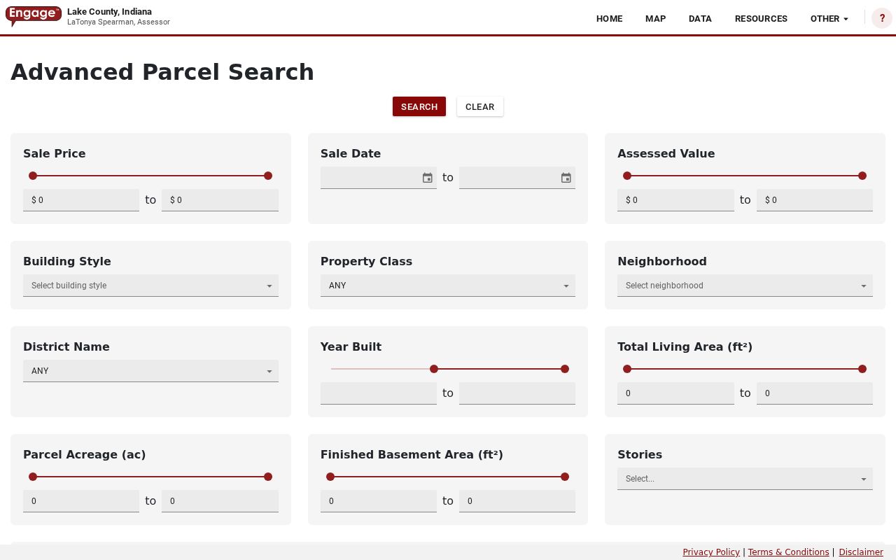
The advanced form also offers building style, property class, assessed value, bedrooms, stories, and plan. No ZIP filter was observed there. Use GIS when the task is to filter address records by ZIP rather than by street or owner.
See the assessor's advanced search fields before reviewing the captured form below.
Gary Street Directory Record Layers
No single Gary address roll answers every question. Use the source that matches the fact being tested, and keep the access gap visible when a public search was not confirmed.
| Address record | Gary or Lake County keeper | Street evidence | Access limit |
|---|---|---|---|
| Assessment roll | Lake County Assessor | Owner, situs, mailing address, parcel, value, legal description | Current property evidence, not all occupants |
| Parcel geography | Lake County GIS | Polygons, municipality, township, ZIP, tax set, system links | Current layer, not a survey |
| Recorded instruments | Lake County Recorder | Deeds, mortgages, liens, plats, releases | Public route redirects to account login |
| Voter status | Indiana Voters and Lake Elections | Known person's registration and polling context | No open street-wide web roster |
| Permits and service cases | Gary Building, Code Enforcement, and 311 | Address-linked permit, inspection, or complaint clues | No verified public history browser |
| Older listings | Gary Public Library and Indiana State Library | Printed name and address in selected years | Gaps; reverse run not confirmed |
The parcel number is the best handoff between the assessor, GIS, recorder, and treasurer. Street spelling connects later records to the library shelf. For a modern street directory, record the date each system was checked because public rolls change.
Browse Gary Streets in GIS
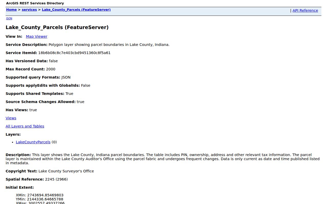
The Lake County parcel service exposes street number, direction, name, suffix, city, ZIP, mailing fields, legal description, acreage, property class, municipality, and township. It also provides links to recorder, assessor, and treasurer systems. This link triangle turns one parcel ID into a controlled handoff across three record systems.
Query a street name and city, inspect each returned parcel, then follow only the links needed. The service supports queries, distance searches, pagination, and geometry. Its maximum record count is 2,000, and it can export formats that include CSV, GeoJSON, KML, and Excel. A large export is not proof of residence and should not replace review of each parcel.
Open the public parcel layer description before using the technical view shown here.
Trace Gary Deeds by Street
Begin with the assessor's current owner and legal description. Use the parcel link or the Lake County Recorder search route to seek the newest deed into that owner. Read its grantor, grantee, recording date, document number or book and page, and legal description. Then search the grantor as an earlier grantee and repeat.
The online route redirected to member login during research. Its start year, field labels, image charges, and pagination could not be verified. That makes the fallback vital: contact the Lake County Recorder at the Crown Point counter, by phone, or in writing. Give staff the parcel ID, legal description, names, date range, and desired copy form. Older books and the county's Book Scanning Project may cover records that are not exposed in the public interface.
Counter shortcut. The Recorder is at 2293 North Main Street, Building A, second floor, and lists weekday hours from 8:30 a.m. to 4:30 p.m.
Gary Addresses West of Broadway
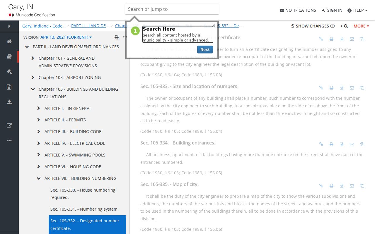
Gary's municipal code uses Broadway as a core east-west reference and describes west-side forms with a number, west designation, street, or avenue. The city engineer is charged with keeping a map of additions, subdivisions, lots, blocks, streets, and building numbers. That framework matters when an old street directory prints a form that differs from a modern postal result.
No official citywide renumbering year or complete conversion table was found. Bridge an old address with the direction from Broadway, subdivision and lot, parcel ID, legal description, and a map from the same period. State Library holdings include Lake County maps from 1911 and 1912 and a Gary city-engineer map from 1915. Sanborn sheets add block and building detail.
Review the Gary building-number rule alongside the captured ordinance page.
Note: Never assume that the same printed number identifies the same lot across decades without checking a period map.
Gary Permits and Voter Clues
Gary Building routes building, electrical, HVAC, and plumbing permits through OpenGov. The city says inspections can be set 24 to 72 hours ahead and lists a $50 inspection and $100 reinspection charge. Those facts describe the permit process. Research did not confirm a public portal that reveals a complete permit history by address, so ask the department for a specific parcel and time range.
Gary 311 accepts an address, department or request type, description, photograph, and contact details. It is a way to report service needs, not a residents list. Code Enforcement likewise discusses inspections and citations, but no open historical case browser was found.
Indiana Voters checks a submitted first name, last name, date of birth, and county. A broader voter-file request follows a separate county or state process and includes confidentiality limits. Protected voters and identifying numbers are not ordinary public output. Use it to test a person already known, never to promise every Gary resident on a block.
Gary Street Directory Archives
The Gary Public Library Indiana Room lists city directories for selected years from 1908 through 1960, plus yearbooks, newspapers, obituaries, maps, and the WPA Index. Ask for a street section, telephone book, reverse directory, or criss-cross supplement by name. Neither the library page nor the State Library list proves that a complete reverse run survives.
The WPA Index covers Gary subject headings from 1906 through 1939. Its headings include streets and names, neighborhood houses, wards, organizations, and City Clerk or Council material. That makes it a useful bridge from an address to a newspaper clipping or municipal topic, though it is not a list of everyone who lived there.
Historical directory collections belong in a year-by-year shelf search. Details on their publishers and holdings appear on the Gary city directories page, while the street search should stay focused on the address section and map match.
Limits of a Gary Street Directory
A Gary street directory cannot supply a full current household. Parcel files name deeded owners, not every person inside a building. Mailing addresses may point to an office or agent. The public voter form only checks a known registrant. Utility customer records, motor-vehicle address data, student records, and protected-program addresses are not general street-search material.
Older sources also require care. A city directory entry proves that a publisher listed a person at an address in that edition. A Sanborn map shows a structure and its use, not its occupants. A deed proves an interest in land, not continuous residence. Compare at least two sources before drawing a conclusion, and note the date of each.
Use records lawfully. Gary address records support family, property, and civic research. Never use a street search to stalk, harass, intimidate, or harm anyone.